


Flood Models
Geosapiens’ solution provides flood risk modeling for fluvial, pluvial, and coastal flooding, both under current climate conditions and across various climate change scenarios. By delivering property-level risk assessments, it enables you to precisely quantify vulnerabilities, protect your assets, and better manage your exposure.
Flood risks take many forms
Geosapiens’ risk models stand out for their precision and adaptability, offering comprehensive coverage of the different types of flooding:

Fluvial Floods
Pluvial Floods

Coastal Floods
Geosapiens’ fluvial flood model simulates river and stream dynamics using our proprietary hydrological model. It determines flow rates and water levels for multiple return periods, with outputs feeding into a hydraulic simulation of watershed response. This process integrates high-resolution topographic data from Geosapiens’ GSDEM model to ensure accuracy and local relevance.
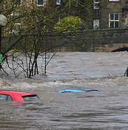
Geosapiens’ pluvial flood model simulates floods caused by intense and sudden rainfall that saturates soils and drainage systems. These events, often unpredictable and localized, require highly detailed modeling. Our approach integrates climate and land-use data to reproduce rapid surface water accumulation and accurately identify high-risk areas.
Geosapiens’ coastal flood model simulates the effects of storm surges, sea level rise, and tidal variations on coastal areas. It incorporates the complex interactions between marine forces and coastal features, such as geomorphological configuration and urban development. By integrating these factors, the model delivers accurate estimates of coastal flood risk.
Financial Loss Model
Geosapiens’ financial model estimates the economic losses associated with floods by analyzing their impacts on properties and portfolios. It relies on hazard modeling data and insured property characteristics, such as value and type, to produce an estimate of potential damages.
The model outputs include detailed loss estimates at both the property and portfolio level, Annual Average Loss (AAL), Probable Maximum Loss (PML), and other key financial indicators. These results provide insurers and financial institutions with actionable insights to improve underwriting, optimize portfolio management, and strengthen capital planning.

Geographic coverage
Our flood models are available across Canada and will soon be extended to the United States. Upon request, data can be provided at the scale of a state, province, or specific region. Contact us to learn more about availability based on your geography or needs.


Characteristics of Our Model
Locally calibrated, globally scalable
Geosapiens’ models integrate local and regional specificities for enhanced accuracy, while remaining easily deployable at a large scale. This unique approach provides a detailed and granular view of risks, without compromising coverage or performance.
Multidisciplinary approach
The Geosapiens team brings together experts in climate science, hydrology, GIS, artificial intelligence, and software development. This diversity of expertise enables the design of robust, comprehensive models that are tailored to real-world conditions and market needs.
Industry-validated reliability
Geosapiens’ models have been rigorously tested and validated by leading insurance players, ensuring their reliability, accuracy, and relevance for flood risk management and pricing.
Reduced over- and under-prediction
Geosapiens’ models reduce the biases of over- and underestimation of risks, enabling more accurate pricing. This reliability fosters client trust and supports the development of products that are both viable and profitable.
Flood-related news


