
November 3, 2026 · Geosapiens
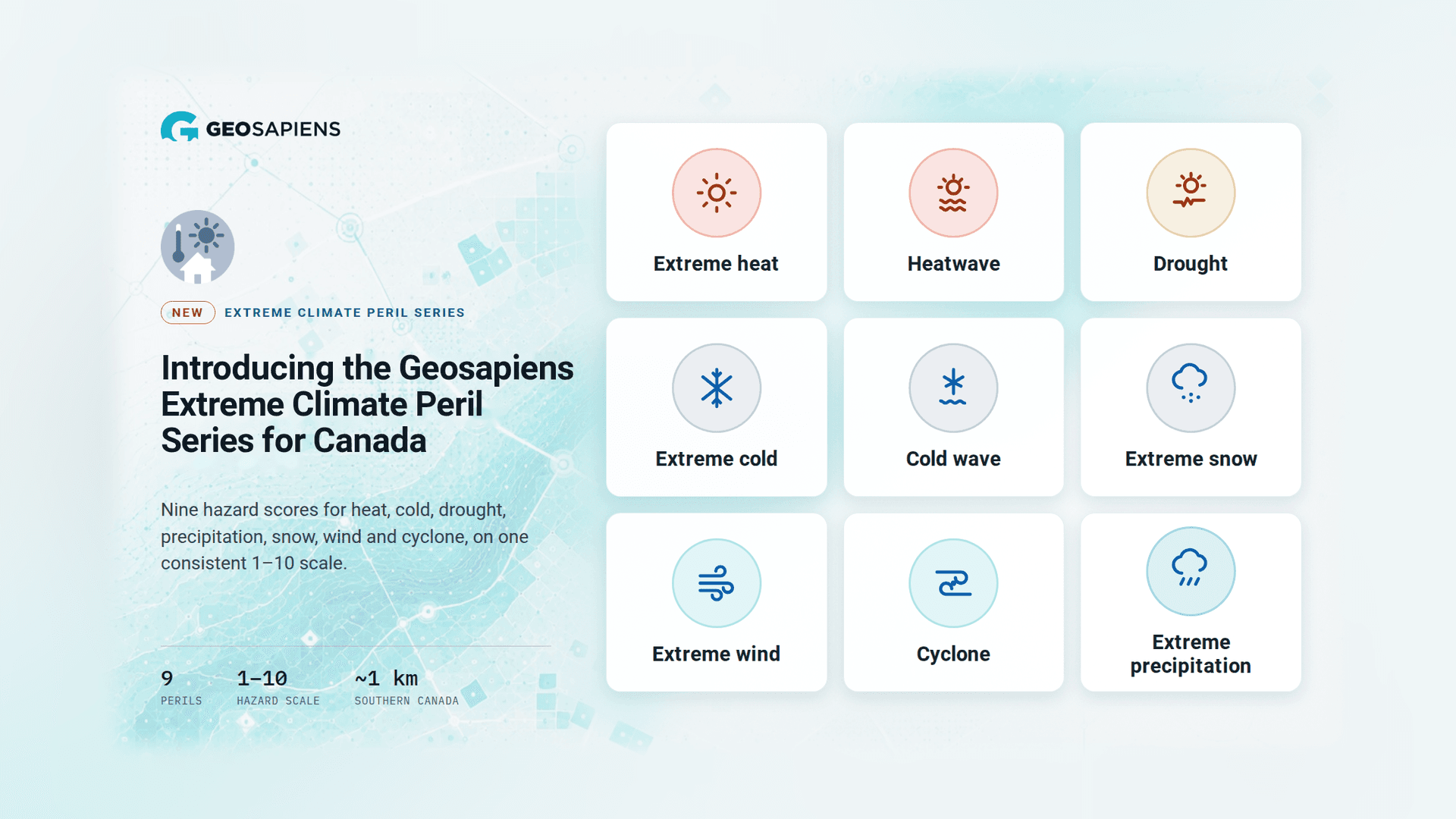
New series adds heat, cold, drought, precipitation, snow, wind and cyclone to Geosapiens’ flood, wildfire and hail models, for a fuller picture of risk and of what it means to live in a place.
Québec City , November 3, 2026 — Geosapiens announced the launch of its Canada Extreme Climate Peril Series providing insights into nine climate perils to help insurers, financial institutions, real estate professionals and public agencies look beyond flood, wildfire and hail to see the full range of climate perils affecting their properties and portfolios.
Climate risk in Canada goes well beyond the headline perils. Prolonged heatwaves, severe cold snaps, heavy snow loads, damaging winds and intense rainfall can all stress buildings, disrupt operations and drive losses, yet they often remain blind spots in risk assessment. The new series brings these overlooked exposures into the risk picture, with Canada-wide coverage.
Nine perils, one consistent scale
The series covers:
Each peril is modeled with its own climate data and methodology, then translated into the same 1–10 hazard scale, from 1 (lowest) to 10 (highest). Users or Organizations can compare perils side by side and interpret results consistently across properties and portfolios.
A more complete view, together with flood, wildfire and hail
The Extreme Climate Peril Series expands Geosapiens’ climate risk offering beyond flood, wildfire and hail.. Used together, they give a more global view of climate risk: the headline perils that drive the largest losses, plus the chronic and extreme conditions that wear on buildings, people and operations over time. A property that looks safe from flood may still face recurring heatwaves, heavy snow loads or damaging winds, and seeing all perils on the same scale helps teams understand the full risk profile of every location.
Know the where: more than a risk score
The Extreme Climate Peril Seriessay as much about places as they do about risk. Read on a simple 1–10 scale, they show where each peril is low, typical, elevated or extreme, and how that pattern is distributed across the territory. The result is a clear, general view of the climate conditions that come with a location, conditions that shape daily life, comfort and quality of life in a community, not just the cost of insuring a building.
That makes the series useful well beyond insurance. For real estate, it helps buyers, investors, developers and advisors compare locations and choose where to buy, build or settle, with a consistent reading of how each place stands relative to others. Whether the question is pricing a risk or choosing a home, the Extreme Climate Peril Series helps people know more about the where, and choose where with confidence.
Science you can review and defend
The models are built on recognised scientific data and established climate modelling approaches, providing a consistent and reliable view of climate perils across Canada. Each peril is modelled independently to reflect its unique characteristics, while results are standardised to make them easy to understand and compare across locations. With resolution of approximately 1 km in southern Canada, the series provides detailed climate intelligence to support analysis at the local level.
Built for insurance and real estate decisions
Available now, wherever decisions happen
The Canada Extreme Climate Peril Series is available today through:
See what extreme climate perils reveal in your own book. Request a demo at geosapiens.com/models/extreme-climate-perils.
About Geosapiens
Geosapiens is a Canadian company specializing in climate risk modelling and intelligence. Its multi-peril modeling solutions covering floods, wildfire, hail and other extreme climate events help organizations understand how climate affects every location they insure, finance, own or manage.
Available through the Portal, APIs, data, its solutions integrate into decision-making and technology processes and evolve with its clients’ needs.